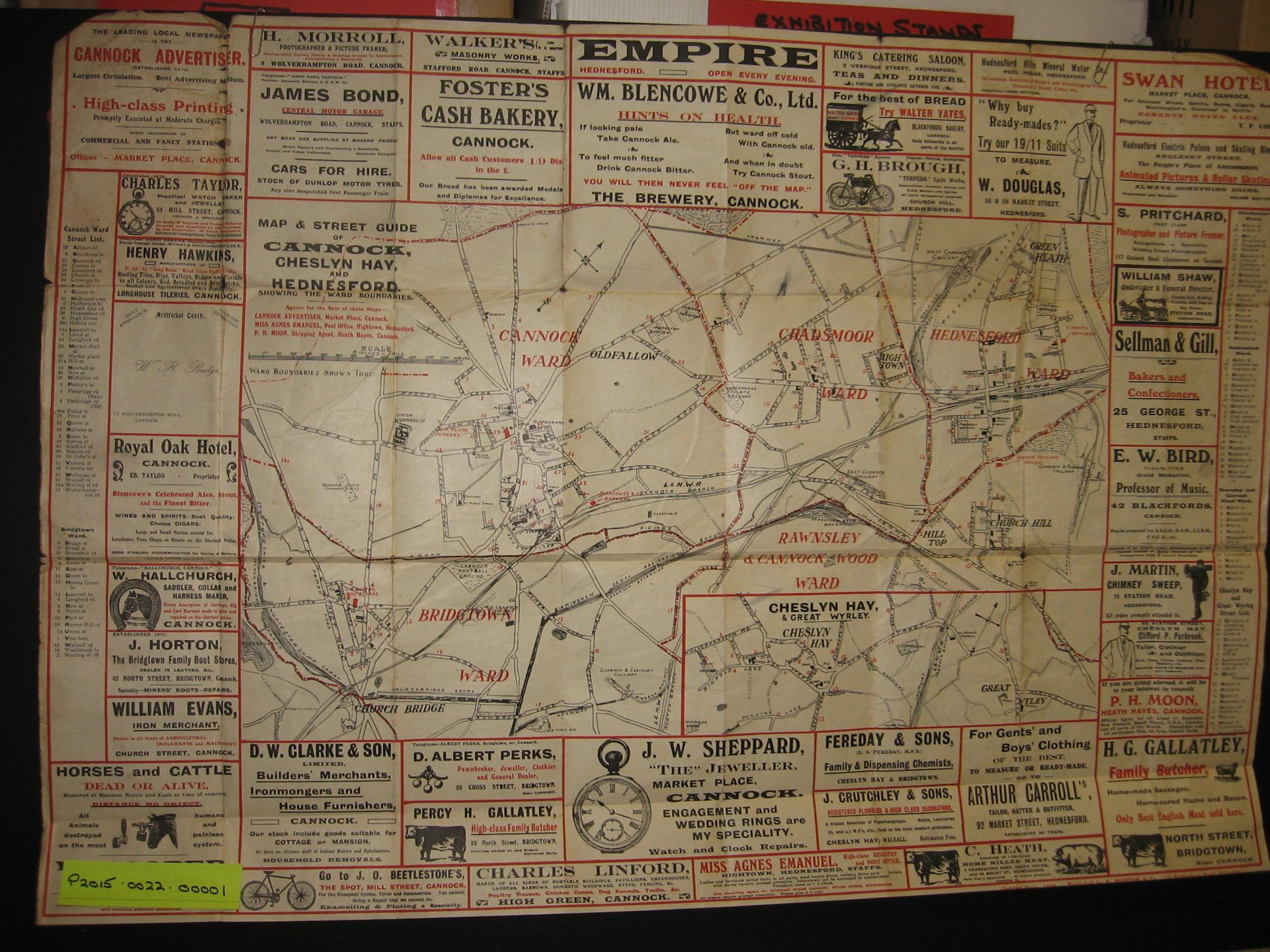
The Maps and Plans Collection features a wide range of hand-drawn and printed maps and plans, primarily relating to industry, infrastructure, and local governance.
It includes colliery company plans, engineering drawings, geological surveys, and transport maps showing railway and canal networks. Also included are land use plans, Ordnance Survey maps, and architectural drawings from housing and building developments across the district.
Here’s a few examples of objects in this collection.